Oxford Student Atlas
₹425 Original price was: ₹425.₹380Current price is: ₹380.
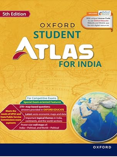
Oxford Student Atlas has been an indispensable companion in academic pursuits. Its comprehensive content, up-to-date information, and student-friendly design make it an essential tool for understanding and navigating the complex world of geography and related subjects.
In stock
Oxford Student Atlas for Competitive Exams
Oxford Student Atlas has been an invaluable resource in academic journey, offering a wealth of geographical information and aiding me in various subjects. Here’s a detailed description of the book:
Key Features:
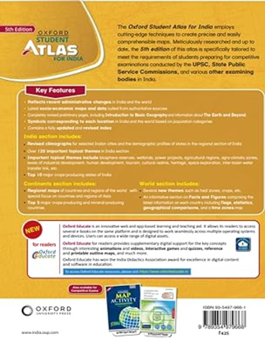
- Comprehensive Cartographic Representation: The Oxford Student Atlas provides a comprehensive and detailed cartographic representation of the world, including maps of India with state boundaries and individual state maps. The maps are designed to meet the academic requirements of students and cover a diverse range of topics, from physical geography to socio-economic data.
- Up-to-Date Information: The atlas is regularly updated to reflect the latest geopolitical changes, ensuring that the information provided is current and relevant. This feature is particularly important for students like me who need accurate and updated data for various academic subjects.
- Clear and Informative Maps: The maps in the Oxford Student Atlas are presented in a clear and visually appealing manner. The use of vibrant colors, labels, and legends makes it easy to interpret geographical features, enhancing my understanding of different regions, topography, and political boundaries.
- Inclusion of Thematic Maps: Beyond traditional political and physical maps, the atlas incorporates thematic maps that cover specific topics such as climate, population, agriculture, and more. This diverse range of maps aids in a deeper understanding of various subjects and facilitates a holistic approach to geographical studies.
- Focus on India: For students studying Indian geography, the detailed maps of India at different scales provide a thorough understanding of the country’s topography, states, and Union Territories. The inclusion of demographic and economic data enhances the utility of the atlas for subjects like Indian Polity and Economics.
- Educational Charts and Graphs: In addition to maps, the atlas includes educational charts and graphs that complement the geographical information. These visual aids serve as valuable tools for understanding statistical data and trends, making complex concepts more accessible.
- Student-Friendly Design: The atlas is designed with students in mind, featuring a user-friendly layout that allows for easy navigation. The inclusion of a comprehensive index helps quickly locate specific places, making it a practical and efficient study tool.
- Durable Construction: The Oxford Student Atlas is usually crafted with durable materials, ensuring that it withstands the wear and tear of regular use. This durability is crucial for students who rely on the atlas for prolonged study sessions and exam preparation.
- Access to Digital Resources: Depending on the edition, the Oxford Student Atlas may offer access to digital resources such as online maps, quizzes, and supplementary materials. This feature enhances the learning experience by providing additional resources for further exploration and self-assessment.
In conclusion, the Oxford Student Atlas has been an indispensable companion in academic pursuits. Its comprehensive content, up-to-date information, and student-friendly design make it an essential tool for understanding and navigating the complex world of geography and related subjects.
| Weight | 370 g |
|---|---|
| Publication | Oxford |
| Language | English |
| Edition | 5th |
| ISBN | 9789354979668 |









Reviews
There are no reviews yet.